
Bestaand:Nicolaes Visscher Indiae Orientalis.jpg
Groutde van disse weadergåve: 720 × 600 bealdpunten. Andere resolutys: 288 × 240 bealdpunten | 576 × 480 bealdpunten | 922 × 768 bealdpunten | 1.229 × 1.024 bealdpunten | 2.493 × 2.077 bealdpunten.
Oorsprungelik bestand (2.493 × 2.077 bealdpunten, bestandsgroutde: 1,89 MB, MIME-type: image/jpeg)
Beskryving
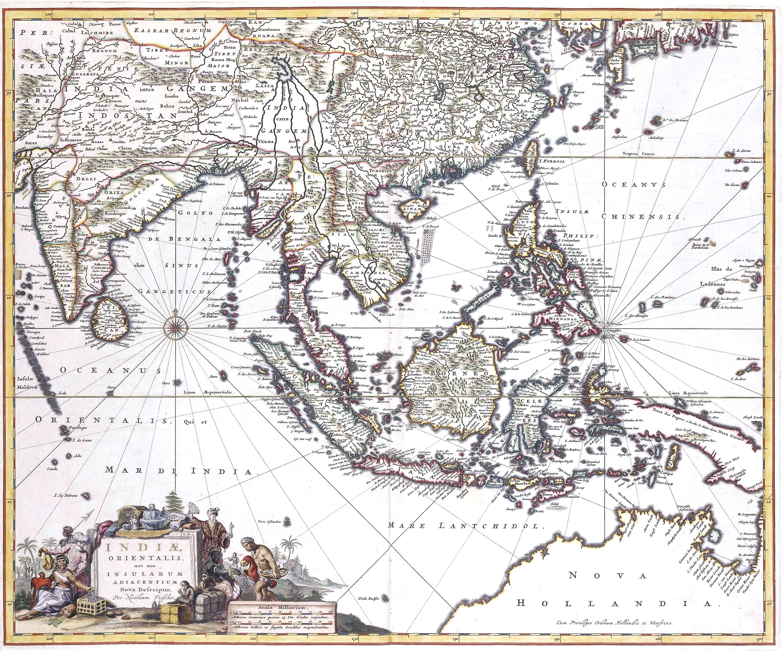
| Nicolaes Visscher: New description of East India, and also the Adjacent Islands
( |
||||||||||||||||||||||||||
|---|---|---|---|---|---|---|---|---|---|---|---|---|---|---|---|---|---|---|---|---|---|---|---|---|---|---|
| Kunstenaar |
|
|||||||||||||||||||||||||
| Titel |
Latijn: Indiae orientalis, nec non insularum adiacentium nova descriptio New description of East India, and also the Adjacent Islands |
|||||||||||||||||||||||||
| Beskryving |
Indiae Orientalis, 17th century map by by Nicolaes Visscher II |
|||||||||||||||||||||||||
| Dåtum | 17e eeuw | |||||||||||||||||||||||||
| Bron/fotograaf | Het Geheugen van Nederland | |||||||||||||||||||||||||
Licensy
|
Dit werk bevindt zich in het publiek domein in landen en gebieden waar de auteursrechttermijn het leven van de auteur plus 100 jaar of minder is. | |
| Van dit bestand is vastgesteld dat er geen bekende auteursrechtaanspraken op rusten, alle aanverwante en naburige rechten daarbij inbegrepen. | |
Bestandsgeskydenisse
Klik up een datum/tyd üm et bestand te seen so as et destyds was.
| Datum/tyd | Miniatuurafbealding | Groutde | Gebruker | Kommentaar | |
|---|---|---|---|---|---|
| aktueel | 19:31, 11 apr 2021 | | 2.493 × 2.077 (1,89 MB) | Gryffindor | {{Information |Description= |Source={{own}} |Date= |Author= Gryffindor |Permission= |other_versions= }} |
| 17:03, 8 sep 2007 |  | 2.493 × 2.077 (1,93 MB) | Jan Arkesteijn | {{Information |Description=Indiae Orientalis, 17th century map by Nicolaes Visscher |Source= Nicolaes Visscher |Date=17th century |Author= Nicolaes Visscher |Permission=PD because of age |other_versions= }} Category:Nicolaes Visscher |
Bestandsgebruuk
Dit bestand wördt up de volgende syde gebruked:
Globaal bestandsgebruuk
De volgende andere wikis gebruken dit bestand:
- Gebruuk up ban.wikipedia.org
- Gebruuk up en.wikipedia.org
- History of Indonesia
- Majapahit
- Indonesia–Malaysia confrontation
- Srivijaya
- Amboyna massacre
- Singhasari
- List of governors of the Dutch East Indies
- Sultanate of Serdang
- Aceh War
- Mataram Sultanate
- Bone State
- Effect of the 2004 Indian Ocean earthquake on Indonesia
- Javanese historical texts
- Permesta
- Shailendra dynasty
- Johor Sultanate
- Proclamation of Indonesian Independence
- Kediri Kingdom
- Samudera Pasai Sultanate
- Politionele acties
- Linggadjati Agreement
- Mataram Kingdom
- Lanfang Republic
- Renville Agreement
- New Order (Indonesia)
- Template:History of Indonesia
- 30 September Movement
- Darul Islam (Indonesia)
- Cultivation System
- Pagaruyung Kingdom
- Revolutionary Government of the Republic of Indonesia
- Kingdom of Pajang
- Peureulak Sultanate
- Guided Democracy in Indonesia
- Dutch Ethical Policy
- Asahan Sultanate
- Investigating Committee for Preparatory Work for Independence
- Sanjaya dynasty
- Gilchrist Document
- Supersemar
- Janggala
- Melayu Kingdom
- Roem–Van Roijen Agreement
- Wikipedia:WikiProject Indonesia/Templates
- Operation Kraai
- Banten Sultanate
- Emergency Government of the Republic of Indonesia
Globaal gebruuk van dit bestand bekyken.