
Bestaand:MapNetherlandsWater.PNG

Groutde van disse weadergåve: 450 × 599 bealdpunten. Andere resolutys: 180 × 240 bealdpunten | 580 × 772 bealdpunten.
Oorsprungelik bestand (580 × 772 bealdpunten, bestandsgroutde: 91 kB, MIME-type: image/png)
Deze afbeelding bevindt zich in het publiek domein omdat ze afkomstig is van de website https://www.demis.nl/products/web-map-server/examples/ en is vrijgegeven door de copyright-houder. Het is toegestaan om deze kaart te kopiëren, verspreiden en/of aan te passen aangezien ze gebaseerd is op auteursrechtenvrije gegevens van: www.demis.nl. Zie ook toestemmingsemail op de.wp en een verklaring.
|
| This work has been released into the public domain by its copyright holder, www.demis.nl. This applies worldwide. In sommige landen is dit wettelijk niet mogelijk; in die gevallen geldt: www.demis.nl staat iedereen toe dit werk voor eender welk doel te gebruiken, zonder enige voorwaarden, tenzij zulke voorwaarden door de wet worden voorgeschreven.
|
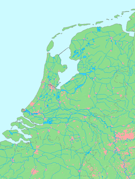
- map shows waterbodies , rivers and canals in Netherlands
derivative works
Afgeleide werken van dit bestand:
Bestandsgeskydenisse
Klik up een datum/tyd üm et bestand te seen so as et destyds was.
| Datum/tyd | Miniatuurafbealding | Groutde | Gebruker | Kommentaar | |
|---|---|---|---|---|---|
| aktueel | 15:00, 14 okt 2015 | | 580 × 772 (91 kB) | Io Herodotus | Afsluitdijk |
| 17:12, 16 okt 2005 |  | 580 × 772 (77 kB) | Michiel1972 | cor. | |
| 15:35, 16 okt 2005 |  | 580 × 772 (77 kB) | Michiel1972 | *map shows waterbodies , rivers and canals in Netherlands *based on free-licence data/map software http://www.demis.nl/home category:Maps of the Netherlands |
Bestandsgebruuk
Geen enkele syde gebruukt dit bestand.
Globaal bestandsgebruuk
De volgende andere wikis gebruken dit bestand:
- Gebruuk up br.wikipedia.org
- Gebruuk up en.wikipedia.org
- Gebruuk up fr.wikipedia.org
- Gebruuk up nl.wikipedia.org
- Gebruuk up ro.wikipedia.org